 Writer: Larry Erickson
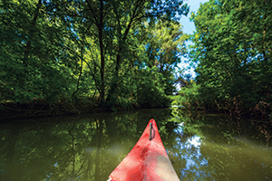
The canoe is America’s original watercraft and still one of the best ways explore inland waterways in the quiet embrace of nature.
That’s especially true in Iowa. Flanked by two of America’s great rivers, most of the state is veined with gentle streams and rills, serenaded by prairie birds and the ripples that rush around rocks.
“There’s just no better place to be,” says Nate Hoogeveen, who wrote the definitive book on the subject: “Paddling Iowa: 128 Outstanding Journeys by Canoe and Kayak.”
Hoogeveen was a journalist with a passion for paddling when he flipped his priorities in 2005, becoming head of the River Programs Team within the Iowa Department of Natural Resources. He still writes a bit, but paddles a lot.
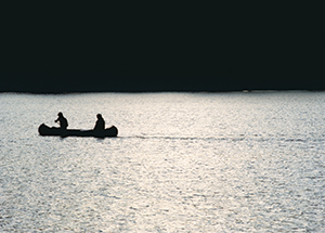 Iowa has 18,000 miles of streams, Hoogeveen says, with the confident tone of someone who has paddled thousands of those miles for his own enjoyment, for his career and in researching his book. They wend among pastures, through canyons, past endless crops and occasionally whip themselves into a frenzy to squeeze through rocky rapids.
“You really do get away from it all on a river,” Hoogeveen says. “Troubles just disappear.”
Iowans in kayaks and canoes are eagerly exploring these long liquid lanes—almost always one-way trips. Paddlers are mostly practical souls. Given their druthers, they head downstream—riding the current, reading the rapids, reaching places in their hearts before places on their maps.
And what places they are! We asked Hoogeveen to recommend five paddling trips around the state that are scenic, fun and safe for paddlers with basic skills. The final five:
 Turkey River
South of Elkader to Garber
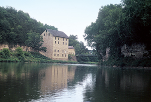
The picturesque Turkey River, averaging 40 yards wide, carves through wooded hills and slips among rocky cliffs in far northeastern Iowa. You can rent canoes, kayaks and tubes from Turkey River Outfitters in Elkader.
Hoogeveen recommends a scenic day trip that covers 11 meandering miles. Start at the Motor Mill Access (adjacent to Retz Woods State Preserve about six miles southeast of Elkader). The starting point is named for the nearby site of a towering stone grist mill that served the area in the 1800s. The trip ends just after the river glides between the towns of Elkport and Garber, at the Garber Access.
“You really can’t believe it’s Iowa,” Hoogeveen says, recalling walls of mossy cliffs rising at riverside.
 Boone River
Albright’s Landing to Tunnel Mill
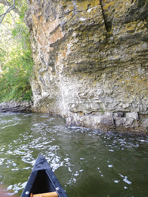
“The Boone River has all the ingredients a paddler loves,” Hoogeveen reports—wooded bluffs, sandstone cliffs, some fast riffles for fun, and water clear enough to support game fish including bass and walleye.
For a fun 7.5-mile stretch, put in at Albright’s Canoe Access on the west side of the river, about three miles south of Webster City and just above Barner Wildlife Area. (Or you can start two miles farther downstream at Bevers Bridge Access). This isn’t a route for a complete novice, Hoogeveen cautions. You’ll start out with a rush: After a long riffle, the river pours over an underwater ledge with surfable waves. For less excitement through this part, stay to the right.
Paddlers are rewarded by lush scenery, a large island and sandbars suitable for picnics. You’ll be flanked several times by limestone cliffs and you’ll encounter a dramatic wooded bluff that looms more than 100 feet over the river. Pull out at Tunnel Mill Access, about 150 yards before County Road R27’s Tunnel Mill Bridge.
 Upper Iowa River
Above Malanaphy Springs
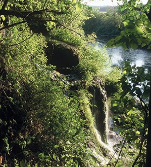
If you like a little more adventure under your keel, try the 8.6-mile stretch of the Upper Iowa River descending into scenic Malanaphy Springs.
Take Hitching Post Road west from U.S. Highway 52. Signs will lead you to the launch site, an access point just below Bluffton Palisades. It’s a spirited section of river, sometimes rushing through narrows as slim as 20 feet wide.
You’ll float among woods, meadows, croplands and overhead bridges on the journey. Past an island, just before a bridge at Malanaphy Springs, you’ll haul out on the left side of the river. Reaching the parking lot requires about a 100-yard portage.
Des Moines River
Deer Creek Access to Fort Dodge
Most Iowans know the Des Moines River from the perspective of the many cities it touches. But the river’s soul is far afield, stretching leisurely for 525 miles from southern Minnesota to its meeting with the Mississippi at Keokuk.
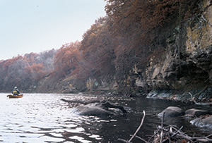 Hoogeveen recommends two segments of the Des Moines for our short list, beginning with 8.4 miles leading into Fort Dodge. A dangerous low-head dam has been removed, leaving a swift current with exciting riffles and rapids. Start at the river access at Deer Creek (just east of U.S. Highway 169 along 130th St.).
After 4.2 miles, you’ll encounter Breens Rapids, where white-water paddlers like to practice. As you paddle into Fort Dodge, the river is cleft by a wooded island, then passes Loomis Park on the left, across from your
take-out site, a boat ramp on the right side of the river. Don’t overshoot the ramp; a nasty dam lurks less than 1,000 feet downstream.
Des Moines River
Keosauqua to Farmington
In southeastern Iowa, as the Des Moines River tires of its travels, lies an inviting 18-mile stretch that provides an ideal weekend paddling opportunity. Equipment is available at Hawkeye Canoe Rental in Keosauqua and at Riverview Retreat in Farmington. The historic river towns of Bentonsport and Bonaparte offer shops, eateries and lodging along the way to Farmington.
By the time the Des Moines reaches this part of the state, it’s as much as 700 feet wide. Part of Bonaparte’s charm is the picturesque, roaring rapids at that stage of the river. The left side is easiest to negotiate, but if you’re not up for adventure you can bail out at a boat ramp in Bonaparte’s city park, then portage downstream to quieter water. When you get to Farmington, your pullout destination is just over half a mile past the roadway bridge.


